Latest News
Berkshire League boys tennis takes shape, sets championships for May 26
Riley Klein
May 23, 2026
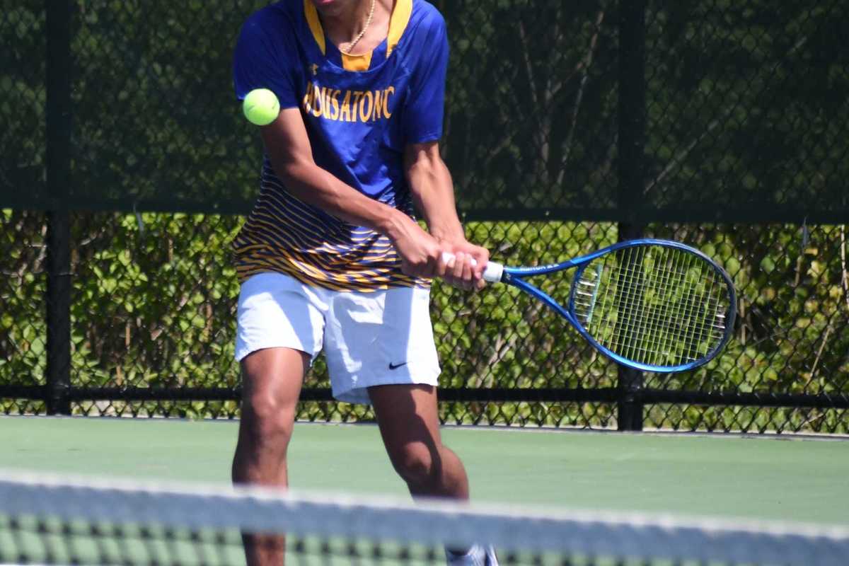
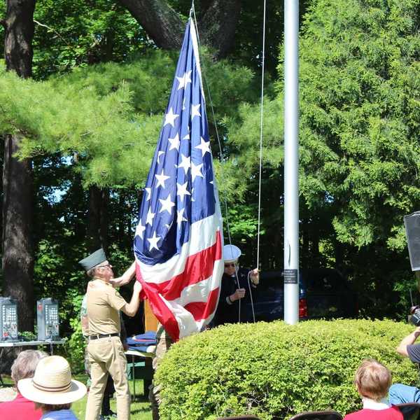
Gustavo Portillo of HVRHS volleys during the opening rounds of the postseason tournament
Riley Klein
LAKEVILLE – Berkshire League boys tennis players gathered at The Hotchkiss School Tuesday, May 19, for the opening rounds of the postseason tournament.
The event featured three separate brackets: varsity singles, varsity doubles and junior varsity doubles. Matches began early in the morning and continued until about 2 p.m. with the temperature cranked up to 90 degrees.
Housatonic Valley Regional High School coach Jeff Tripp remarked, "It was a hot day, but with an early 8 a.m. start the tournament moved at a good pace with excellent play all around."
The JV doubles tournament concluded with a final match of two teams from Nonnewaug High School. The championship-winning pair was Jorni Kuqi and Roman Criscione.
The final varsity matches will be played at Thomaston's Nystrom Park Tuesday, May 26, at 1 p.m.
In the doubles championship, Northwestern Regional High School teammates Lincoln Ouellette and Merrick Bannerman will take on Shepaug Valley High School's duo of Liam Denning and Gabe Tammarro.
The two remaining varsity doubles teams were named Berkshire League all stars.
In the singles bracket, the tournament will continue May 26 with the semifinal round.
Nonnewaug High School's Luke Primini will play David Block from Shepaug. On the other side, Lakeview High School's Luca D'Urso will play Shepaug's Ben Churyk.
The two remaining players from Shepaug, Churyk and Block, did not drop a game in their tournament matches on May 19. Primini, of Nonnewaug, lost just one game. D'Urso emerged from a back-and-forth battle (6-2, 2-6, 10-8) against Northwestern's Braiden Kennedy in the quarterfinal round.
All four players remaining in the singles tournament were named BL all stars. Other all stars for the season included Kennedy, Gustavo Portillo (Housatonic), Luca Inglese (Shepaug) and Jameson McTamney (Lakeview).
Keep ReadingShow less
Plans to revitalize Norfolk’s Infinity Hall unveiled
Jennifer Almquist
May 20, 2026
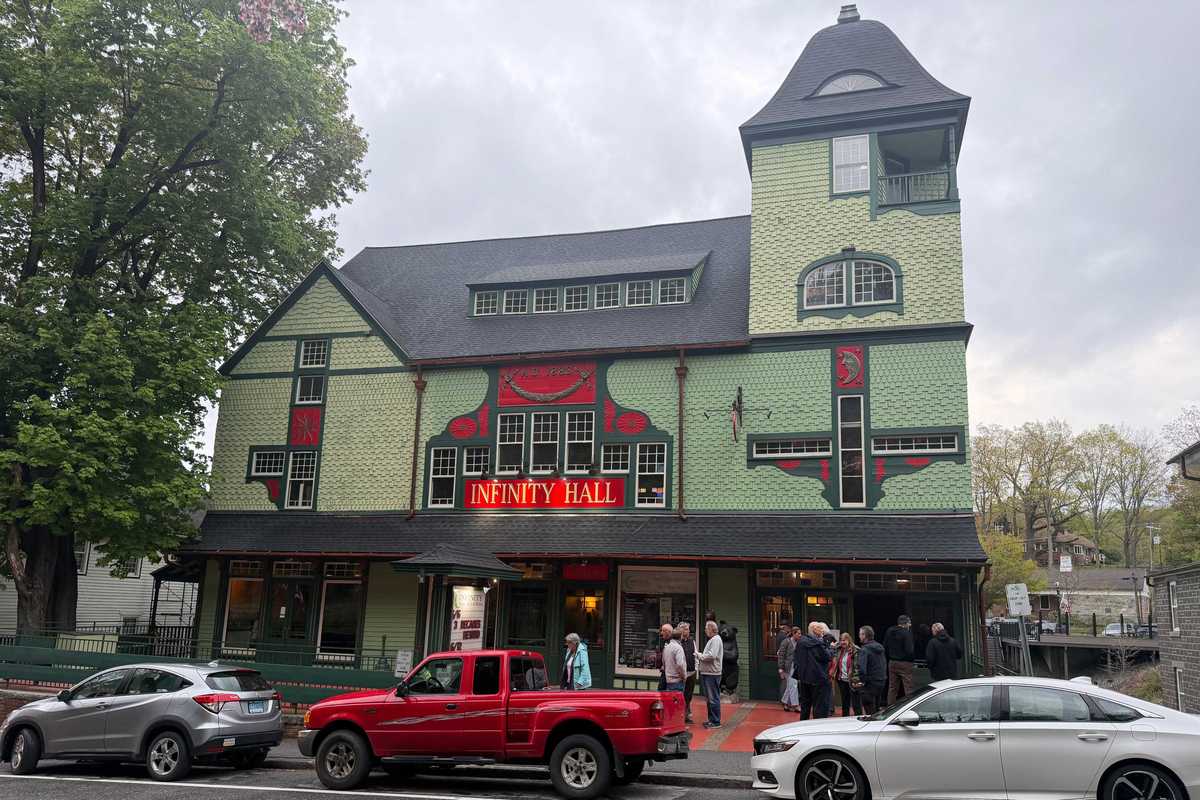
Infinity Hall, built in 1883.
Jennifer Almquist
Nearly 200 people packed the wooden seats of Norfolk’s historic Infinity Hall on Thursday, May 14, as David Rosenfeld, owner and founder of Goodworks Entertainment Group, a live entertainment and venue management company, unveiled ambitious plans to restore the restaurant and bar, expand programming and reestablish the venue as a central gathering place for the community.
Since the Norfolk Pub closed on Jan. 31, 2026, the need for a restaurant and evening gathering place has become paramount, and for years residents have wanted Infinity Hall to be more engaged with the community.
“We have a real opportunity to bring the residents of Norfolk closer together and add to a community already steeped in a rich history of the arts,” Rosenfeld said. “Thursday’s turnout and the positive energy we experienced are the very reason Goodworks exists. We are thrilled to help support and build upon the vibrant community spirit here.”
Built in 1883, Norfolk Village Hall — the former opera house, barber shop and saloon in the center of Norfolk —was designed by Palliser & Co. In 2007, the building was restored as the 300-seat performing arts theater Infinity Hall.
Goodworks Entertainment Group took over Infinity Hall in April 2019. Rosenfeld said he plans to realign the organization with his original dream of doing good works — hence the name.
He also spoke of a large-scale arts and music festival for Norfolk and of conversations with Melvin Chen, director of the Norfolk Chamber Music Festival–Yale Summer School of Music, about a possible winter classical concert series featuring Yale musicians.
After a question-and-answer session, attendees stayed to enjoy live music, food and drinks organized by Lisa Ludwig, general manager of Infinity Hall.
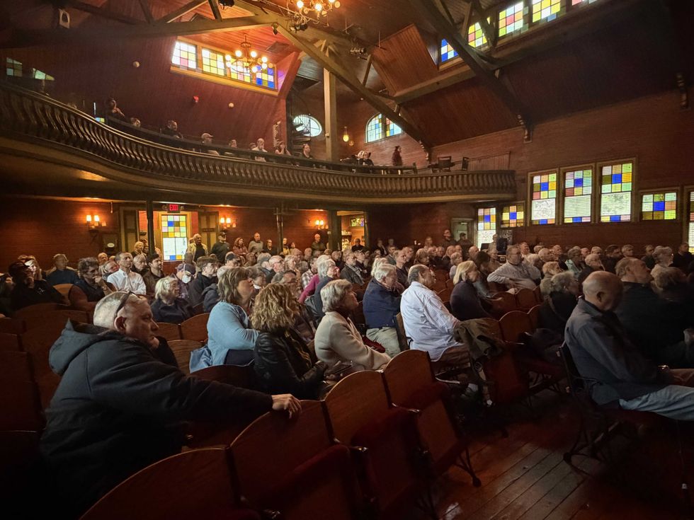 Nearly 200 people gathered at Infinity Hall to discuss possibilities for its future use.Jennifer Almquist
Norfolk resident Tony Kiser praised Rosenfeld’s vision.
“If there is anything to be done, he’s the guy to do it,” Kiser said. “He’s got the experience, some capital to invest, and he has a vision.”
Henry Tirrell, Norfolk first selectman, welcomed the prospect of renewed activity at the venue.
“I am excited to see an option for dinner and drinks in town, as well as increased activity at Infinity Hall,” Tirrell said.
Cheryl Heller, chair of the Norfolk Economic Development Commission, said the announcement represents an important moment for the town.
“Infinity is a key part of Norfolk’s identity, and for the last few years that it’s been quiet, the community has felt the loss,” Heller said. “This announcement is tremendously exciting, not only because of the new restaurant and programming, but because David’s plans include contributing to the culture and life of the town.”
“I am completely delighted with the new direction,” said Norfolk activist and Economic Development Commission member Libby Borden. “I certainly hope Norfolk supports Infinity Hall in every way.”
Keep ReadingShow less
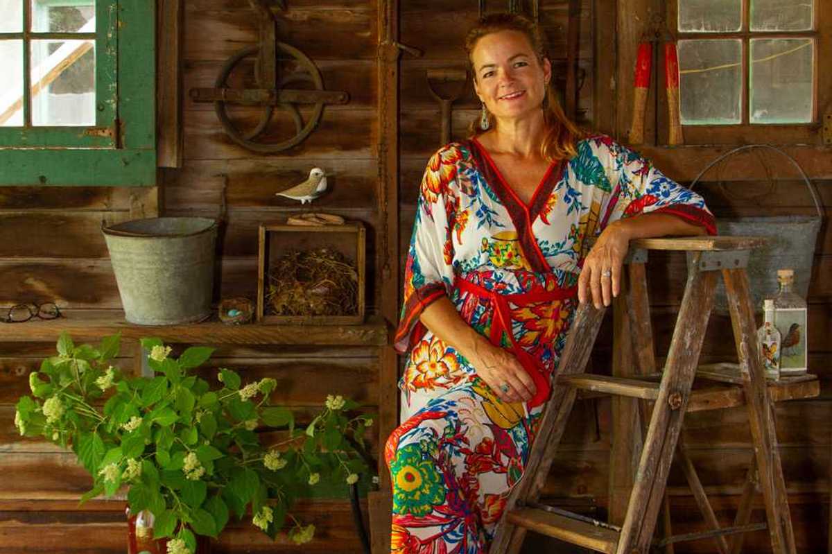
May Castleberry’s next chapter
Richard Feiner And Annette Stover
May 20, 2026

May Castleberry at home in Lakeville.
Natalia Zukerman
Castleberry’s idea of happiness is “looking at a great painting.”
May Castleberry is a ball of sunshine and passion, though she grew up an introverted child, moving with her family from Alberta to Colorado to Texas, finding comfort in mountains, books and wide-open skies. Today, the former art book editor and museum curator has found a new home in Lakeville, where the natural beauty of the Northwest Corner continues to captivate her. Whether walking with friends, painting, reading or visiting beloved local libraries in Salisbury, Norfolk and Cornwall, Castleberry has embraced the region since making her move permanent in 2022, bringing with her a remarkable career shaped by a lifelong love of books and art.
Castleberry grew up in the world of books, and especially art books, and she credits her artist mother, an avid art book collector, with igniting her passions. Castleberry’s high school art teacher in Dallas understood how to teach students to channel their imaginations into books and art.
Castleberry and her husband, Michael FitzGerald, a professor of art history at Trinity College and research director of an art foundation based in Europe, first moved to Lakeville in 2013 when their son attended Hotchkiss.
In college in Texas and graduate school at Columbia and NYU, Castleberry learned every aspect of fine art book production, from paper and design to the quality of printed reproductions and original works.
“I studied printmaking, design, art history and the history of the book,” said Castleberry. “In college, I learned even more when I started work as an art librarian. I haunted antiquarian and art book shops every weekend in New York City and wherever I traveled and was shaped by what I saw. I also took courses in papermaking and printmaking in my spare time.”
Castleberry entered the museum world in 1980 when she joined the Whitney Museum as a librarian.
“At the time, it was an underfunded one-person library, so not an obvious prize, but it turned out to be a great place to grow.”
When asked to help raise funds for acquisitions, she proposed creating a publishing program and, over the next 17 years, conceived, edited and produced over 20 books as the editor of the Whitney’s Artists and Writers Series. Castleberry also curated exhibitions of books, prints and photographs, culminating in a large-scale show about photography and photobooks titled “Perpetual Mirage: Photographic Narratives of the Desert West” in 1996.
After 20 years at the Whitney, Castleberry moved to the Museum of Modern Art to develop an artist’s book program that would explore the art of the book and help support the museum’s archives and library. This program, the Library Council, continued until Castleberry retired from MoMA late last year. During that time, she also organized an exhibition at New York City’s AXA Gallery on photography of archeological sites in the Americas: “The New World’s Old World.”
Asked about favorite stories from her museum roles, Castleberry recounts “looking for several very different artists to commission to make prints for ‘The Magic Magic Book’ by sleight-of-hand artist, collector and historian of magic Ricky Jay, and approaching artist Tomás Saraceno about making a pop-up book about spiders.”
Shortly after moving to Lakeville permanently, Castleberry heard about a part-time job coordinating events at the Scoville Library. She expected her program at MoMA to be shut down by the pandemic and thought the opportunity would be a great way to get to know the library, its staff and the community.
“I invited the poet Sally Van Doren to start a monthly poetry workshop, and artist and teacher Lily Rand to teach bookbinding and other classes. I was thrilled to bring in the founder of the Brooklyn’s Dieu Donné Papermill — one of the great papermakers in the world — as well as paper marblers and others for a series of outdoor art classes.”
MoMA’s Library Council revived only a few months later, and Castleberry no longer had the time her Scoville work required.
“Happily, I was replaced by the amazing Karen Vrotsos,” said Castleberry of the library’s current head of adult programs. “I am still in close contact with Karen Goodell, the library director, the library staff and some of the trustees.”
Castleberry’s idea of happiness is “looking at a great painting.”
In the region, her favorite art museums are the Clark in Williamstown, Massachusetts — which she recently supported by donating nearly all the books she worked on at the Whitney and MoMA to its art library — as well as Connecticut’s Hill-Stead Museum in Farmington and the Wadsworth Atheneum Museum of Art in Hartford.
Now newly retired from her museum position, Castleberry has returned to her passion for drawing and painting. She’s also in the initial planning stage of a museum book project. Stay tuned for her next chapter.
Keep ReadingShow less

Want more of our stories on Google? Click here to make us a Preferred Source.
Hoarding With Style: Sarah Blodgett’s art of collecting
Kerri-Lee Mayland
May 20, 2026
Sarah Blodgett has turned her passion for collecting into “something larger.”
Photo by Sarah Blodgett
There is something wonderfully disarming about walking into a space where nothing feels overly polished, overly planned or pulled from a catalog — a place where history lingers in the corners, where color is fearless, where the objects on the shelves have stories to tell and where, if you are lucky, a cat named Cinnamon may be supervising the entire operation.
That is the world of Sarah Blodgett.
Now part of the creative orbit inside Liz Macaire’s sprawling gallery in West Cornwall, Blodgett’s “Hoarding With Style,” tucked into the upstairs space, feels less like a shop and more like an unfolding conversation about aesthetics, storytelling and the art of living with things that matter.
Born in Manhattan, Blodgett spent weekends and much of her childhood in Gallatin, New York where her family owned a late-1700s farmhouse on a property that once housed an antique store, leaving the barns packed with treasures and forgotten finds.
“I was dusting off antiques instead of playing with toys as a child,” she said, laughing.
In sixth grade, she recruited friends to venture into an abandoned house, move things around, style found objects and create little vignettes while her mother supervised from a nearby chair. Looking back, it seems inevitable that Blodgett would eventually build a business rooted in collecting, storytelling and visual imagination.
Photography came first. Her father was a professional photographer in New York, and Blodgett followed him into the field, eventually building a career photographing wildlife, sports and portraits while simultaneously collecting antiques and pieces that fed her layered aesthetic.
For years, she joked about turning her passion into something larger. She trademarked the name “Hoarding With Style,” a process that took nearly two years. Once it finally came through, she laughed.
“Well, I guess I should use it.”
As photography rapidly changed in the age of cellphones and artificial intelligence, Blodgett began rethinking what creativity could look like moving forward.
“We also realized we had too much stuff,” she said. “So we started selling pieces on Facebook Marketplace.”
Only Blodgett could not help elevating even that process. Inside her Greek Revival home in West Cornwall, she created styled moments around the things she was selling. People responded not just to the objects, but to the feeling behind them.
Her philosophy is approachable, with affordability in mind. She believes homes should evolve slowly over time, layered with meaningful objects, history and personality rather than stripped down into sterile perfection.
“That’s what gives a home a soul,” she said.
Creativity runs throughout the family. Her husband, a German comedian and juggler, performs internationally, while their 22-year-old child, Badger, is heading to the Maryland Institute College of Art this fall. One of the couple’s four children in their blended family, Badger has even sold some of their own pieces through Sarah’s shop.
“My mom has been such a rock star at supporting me,” Badger said.
Working with clients, Blodgett describes herself as less decorator and more “creativity facilitator,” helping people uncover their own instincts through objects that already reflect who they are.
That is exactly what Sarah Blodgett does: She invites visitors not only to explore her journey, but perhaps to begin uncovering their own.
Hoarding With Style is located at 406 Goshen Turnpike, West Cornwall and is open Friday-Sunday 12 to 4 p.m. or by appointment.
Keep ReadingShow less
Dr. Paul J. Fasano
Lakeville Journal
May 20, 2026
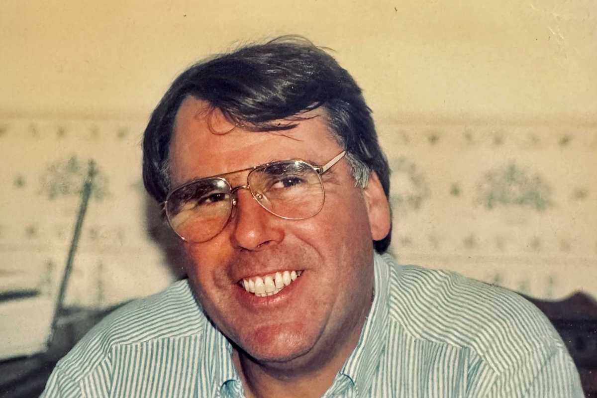
SHARON — Dr. Paul J. Fasano DDS, of Brewster, Massachusetts, passed away peacefully after a long illness on May 10, 2026, in Boston.
Born in Boston to Philip and Laura (Stolarsky) Fasano on Dec. 13, 1946, he grew up in Dorchester with his two brothers Philip and William.Paul attended the Boston Latin School and graduated from Boston College in 1968.He later completed Dental School at New York University in 1972.
He had a successful dental practice in Sharon, Connecticut and enjoyed coaching basketball at Housatonic Valley Regional H.S in Falls Village. After retiring to Brewster, he taught at the Dental Hygiene program at Cape Cod Community College.Paul was a passionate Boston College Eagles fan following all of their teams and his devotion to the Red Sox never faded. He delighted in coaching his three sons in basketball and cheering them on during their football games.
Paul leaves behind the love of his life, Judy, whom he married on Dec. 31, 1973.He is survived by his three sons; Christopher of Alexandria, Virginia, Peter of Orleans, Massachusetts, and Matthew of Kennebunk, Maine, along with his four grandchildren Jack, Lily, Zoey, and Chase whom he loved very much.
Visiting hours will be Wednesday, May 20, 2026, from 4:00-6:00 p.m. at Chapman Funerals & Cremations.678 Main Street Harwich, MA 02645.
A Mass of Christian Burial will be held on Thursday, May 21, 2026, at Our Lady of the Cape Church at 11:00 a.m, 468 Stony Brook Road Brewster, Massachusetts 02631.
In lieu of flowers, the Fasano family requests that a donation may be made to the Peter Frates ALS Foundation on Paul’s behalf, as well as his close friend and late brother-in law, Tom Kane.Peter Frates was a BC Baseball Player and founder of the ALS Ice Bucket Challenge.Donations can be made at www.petefrates.com.
Notes of comfort may be made to his family at www.chapmanfuneral.com.
Keep ReadingShow less
David Niles Parker
Lakeville Journal
May 20, 2026
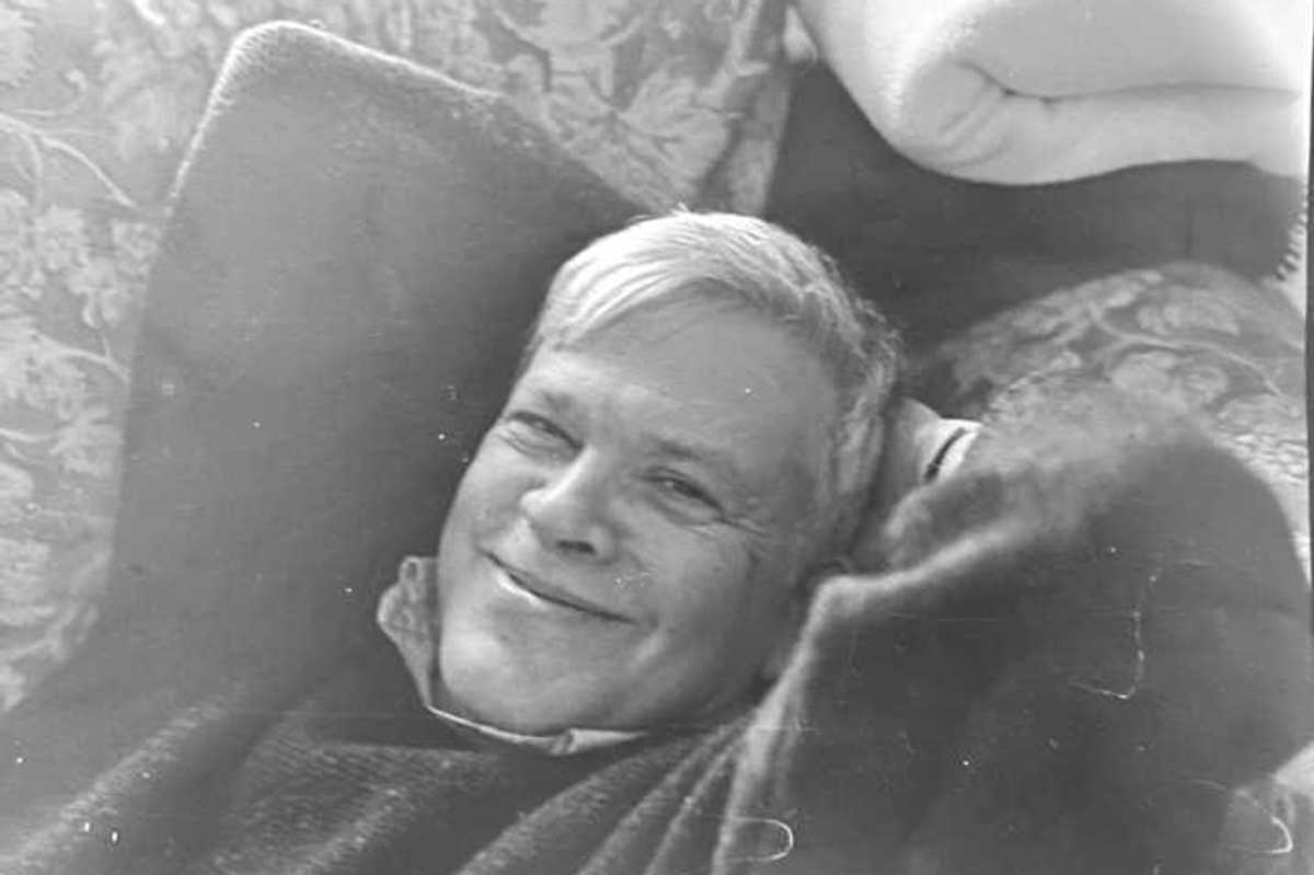
KENT — David Niles Parker, 88, of Middletown, Connecticut, passed away at home on May 6, 2026.
Born January 20, 1938, in Wellesley, Massachusetts, the first child to Franklin and Katharine Niles Parker, David graduated from Wellesley High School, received his undergraduate degree from Wesleyan University, studied at the University of Chicago Divinity School, and earned his master’s in education from Harvard.
David met his future wife, Borngy Hammer, at a college mixer, and in 1962 they married at her family home in South Kent. Together they raised four children and were married nearly 64 years.
He taught English in the Boston public schools, and at the New Milford, Connecticut High School, and took on extra work as a stringer for the Waterbury Republican, covering Kent and Gaylordsville, thereby launching his lifelong career in journalism. In 1968 he took on the job of running a small-town paper, The Millbrook Round Table in Millbrook, New York, where he worked as a reporter, managing editor, photographer, circulation manager and ad sales representative and everything in between. He went on to work at the Lakeville Journal, the Waterbury Republican, the Litchfield County Times, the Torrington Register-Citizen, and the Kent Good Times Dispatch. He also taught journalism courses at UConn, Torrington and took on diverse freelance writing projects, including articles for the New York Times, and a biography of Revolutionary War figure, Dr. Thomas Young. During the Vietnam War he participated in peaceful protests with his fellow Teachers Against War.
Never one to speak of himself, his family would find out by other means of his many talents, awards, and accomplishments. He did not belong to a religion, and considered himself an agnostic, but was a most fine example of a moral, ethical, honest, humble, kind, and good human being; he truly treated every person he ever met with kindness and respect.
He was a great lover of poetry, including that of Richard Wilbur, William Yeatts, Dylan Thomas and Carl Sandburg. He was especially fond of reading aloud poems by A. E. Housman. Literature was such an integral part of his life, and he would often explain himself by quoting a passage or referencing a literary character.
He had a lifelong love of singing and enjoyed doing so for children when they were young. He was especially fond of folk and classical music. In his later years one of his pleasures was to remember and share songs he had learned many decades earlier. When his children were young—and not so-young, each night he would let his children choose the songs he’d sing them, many songs he learned from his father (which his children went on to sing to their children, and their children to sing to his great-grandchildren.)
He also sang in various choirs, including the Kent Singers of which he was a proud and a beloved member.
For eighty-seven years, he spent every summer at his beloved family’s cottage in West Falmouth, Massachusetts. Many summer mornings were spent reading the paper at West Falmouth Market, followed by swimming at Chapoquoit Beach. There he spent many evenings sitting on the porch, singing and looking out onto West Falmouth Harbor.
He was also known to many as an avid sports fan, closely following the Boston Red Sox and UConn Women’s Basketball, a passion that he closely shared with his daughter, Caitlin.
Family was very important and dear to him, and he is remembered fondly and in high regard by family, both close and extended.
David is survived by his wife Borgny of Middletown, his children Stephen of Brattleboro, Vermont; Rolf also of Brattleboro, Vermont; Abigail of Kent, Connecticut; and Caitlin of Durham, Connecticut; grandchildren Julia Holly of Portland, Oregon; Madeleine Holly of Salem, Connecticut; Lily DiTota of Falmouth, Massachusetts; Emma Bournival of Watertown, Connecticut; Allison Mullins of New Haven, Connecticut; Finn Bournival of Durham, Connecticut; and Morgen Parker-Houghton of Brattleboro, Vermont; and great grandchildren Klaus and Grant Schubel of Salem, Connecticut; siblings Anne Schmalz of Bedford, Massachusetts; Theodore Parker of Wellesley, Massachusetts; John Parker of Yarmouth, Massachusetts; as well as many nieces, nephews and family friends.
Services include a private burial at Bulls Bridge Cemetery, at 1 p.m. on May 31, which will be followed by a Celebration of Life at the Kent Community House at 2 p.m.
Keep ReadingShow less
Want more of our stories on Google? Click here to make us a Preferred Source.
loading