Major construction begins on Route 44 in Norfolk

Slope being cleared of trees at the junction of Route 44 and Old Colony Road in Norfolk as part of CT DOT Project 97-95
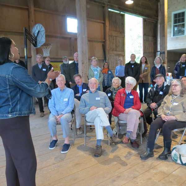
Jennifer Almquist

Slope being cleared of trees at the junction of Route 44 and Old Colony Road in Norfolk as part of CT DOT Project 97-95
NORFOLK — For the next five years, travel on Route 44 will be reduced to one lane in Norfolk, also known as Greenwoods Road West, for the Connecticut Department of Transportation (DOT) to replace existing retaining walls and stabilize the slope along the north side of the road for the safety of the highway.
Last week, DOT Project 97-95, as the extensive undertaking is called, was green lit to begin. Over time the stone retaining walls along the roadway have bulged from the pressure exerted by the angle of the slope and years of heavy rains. In 2010 a mudslide occurred in the affected section of highway which extends from just west of Memorial Green to east of Old Colony Road. In 2019 DOT installed temporary concrete bin blocks, or Mafia barriers (so-called because cement production of them used to be controlled by the mob), along the base of the existing walls due to their movement.
Amy Hare, head engineer for Project 97-95, emphasized the level of preliminary work necessary. Already one family has had to relocate, and their hillside home was just razed. Currently, the town’s water company, Aquarion, is analyzing and relocation of underground water pipes from that section of highway.
Next, Eversource will remove and reconfigure all affected utility poles. Many trees need to be cleared on the slope and on Old Colony Road. The entire site was surveyed. To stabilize the slope during excavation, timber lagging (involves wiring series of wooden slats together to form a blanket) followed by soil anchors will be driven into the hillside to create a supporting wall. Mechanically stabilized earth (MSE) held by metal straps will also be used. Stones removed from the old walls will be available for use by the Town of Norfolk.
The Renkert family, who lost their home, said that they were approached 10 years ago by the state about the need for this construction project. They were sad to leave Norfolk after having raised their children in that home for 19 years and having put considerable work into its renovation.
Mrs. Renkert noted that “the guys from the state were compassionate — really terrific — businesslike, responsive and professional.” The Renkerts say that they were fairly compensated by the state and are comfortable in their new home.
While many adjacent areas will be affected by the construction, DOT is exercising caution to avoid disrupting the cemetery on Old Colony Road. Established in 1757, Norfolk’s historic Center Cemetery is located on the ridge above the unstable slope. Care has been taken to ensure that the integrity of the sacred space will not be violated. Working closely with cemetery officials, project planners established strict protocols to protect the graves and historic markers. Work vehicles entering the cemetery must fit between the two stone gate markers. Radar will be used to establish gravesites. Vulnerable areas will be clearly marked, and a temporary alternate access road will be built. All work will stop when there is a funeral. During the construction process, the public will continue to have access to all burial areas.
Traffic flow on Route 44 is already feeling the impact of the work. One lane will always be kept open wide enough for trucks to pass. An alternate 45-minute detour truck route was devised to move traffic south on 272 (near the Norfolk Library), to Route 4 to Goshen, to Route 63, then looping back up Route 7 to Canaan. Large interstate truckers can either use the suggested detour or go north to use the Mass Pike. For the smaller, local trucking companies the impact will be more severe. Delays that cut down the number of daily runs they can drive will affect their bottom line, according to the folks at George’s Garage in Norfolk. It is too early to fully predict the degree to which travel will be affected. Temporary illumination will be in place for night traffic.
When Project 97-95 is complete, the map area designated as Site #1 will have a retaining wall 1,030-feet-long, 30 to 42-feet-tall, with decorative fencing along the top. Site #2 will have a retaining wall approximately 490 feet long and will be 6-19 feet tall. The current steep slope of 1:1 (45 degrees) will be reduced to 2:1 (27 degrees). The multiple drainage systems along Route 44 that discharge directly into Blackberry River will be reconstructed and consolidated.
The improved highway will have 12-foot-wide lanes. Carving back the banks for the walls will create a wider roadway. Existing narrow shoulders will be widened to five feet allowing for a safer bicycle route. Route 44 is part of the statewide bicycling network.
The retaining walls will be made of segmented pre-cast concrete panels with an architectural “natural stone” finish to be selected by the town of Norfolk. Turf replacement using conservation grass seeds, and small plantings (to retain sightlines) will be established, following environmental and native-species guidelines.
The estimated cost of Project 97-95 is $24 million, with 80% coming from federal funds, and 20% from state funds. While Norfolk will not have to pay directly for the project, the indirect cost and inconvenience will be significant.
Norfolk First Selectman Matt Riiska acknowledged both the cost and the need, “This project has been discussed for a long time. The amount of planning and coordination has been the Department of Transportation’s focus for many years. We have neglected our infrastructure for far too long. Unfortunately, it is going to be another disruptive project for the residents in Norfolk, but these things must be done.”
Salvatore Aresco is the Project Manager for CT DOT Project 97-95.
Lakeville Journal
Garden Help. Looking for an experienced person to weed my acre garden and cut back some plants. In Salisbury. For July and August. Could continue into Fall. naylor99@gmail.com
Home Help Needed. Part Time. Sharon. 407-620-7777.
NOW HIRING - Chef and Kitchen Help. The Millerton Inn is looking for a talented and passionate Chef and line cooks to join our team! If you thrive in a fast-paced kitchen, take pride in creating exceptional food and work well with a team, we’d love to hear from you. Competitive pay. Great team. Growth opportunities. Apply in person at The Millerton Inn or send your resume at themillertoninn@gmail.com
NOW HIRING — Bartenders and Servers. Join the Team at The Boathouse in Lakeville. We’re looking for friendly, reliable, and energetic Bartenders and Servers to join our team! If you enjoy working in a fast-paced, welcoming environment and take pride in providing outstanding customer service, we’d love to meet you. Apply in person at The Boathouse in Lakeville, or contact us at boathouseatlakeville@gmail.com
Hector Pacay Landscaping, LLC. Residential & Commercial. Tree service, Painting, Masonry, Stone Walls, Lawn Mowing, Gardens, Construction. 845-636-3212. CT and NY.
SHARON Huge Tag Sale on Saturday August 1 from 9 to 4 p.m. and on Sunday August 2 from 11 to 4 p.m. at Sharon Methodist Church, 112 Upper Main Street. Our basement is over-flowing. Too much to list. Something for everyone. Also on Saturday is the annual arts and crafts show On the Green. Customers can enjoy shopping at both events.
PUBLISHER’S NOTICE: Equal Housing Opportunity. All real estate advertised in this newspaper is subject to the Federal Fair Housing Act of 1966 revised March 12, 1989 which makes it illegal to advertise any preference, limitation, or discrimination based on race, color religion, sex, handicap or familial status or national origin or intention to make any such preference, limitation or discrimination. All residential property advertised in the State of Connecticut General Statutes 46a-64c which prohibit the making, printing or publishing or causing to be made, printed or published any notice, statement or advertisement with respect to the sale or:rental of a dwelling that indicates any preference, limitation or discrimination based on race, creed, color, national origin, ancestry, sex, marital status, age, lawful source of income, familial status, physical or mental disability or an intention to make any such preference, limitation or discrimination.
1Bd/1b apartment in Amenia. $900 a month. 860-309-4482.
MT RIGA LAKEFRONT CABIN. Private beach, canoe, kayaks, fishing. $1,275/week. 585-355-5245.
Lakeville Journal
Notice of Decision Town of Salisbury Planning & Zoning Commission
Notice is hereby given that the following actions were taken by the Planning & Zoning Commission of the Town of Salisbury, Connecticut on July 20, 2026:
Approved - Site Plan Application #2026-0325 by owner 280 BTLR LLC, for an apartment in a single family residence including modifications of approved site plan # 2025-0305 (for development activities in the Lake Protection Overlay District associated with an addition to a single family residence) such as elimination of a portion of the proposed driveway, construction of new stone walls, and other associated site work in accordance with Section 208 of the regulations. The property is shown on Salisbury Assessor’s Map 67 as Lot 07 and is located at 300 Between the Lakes Road, Salisbury.
Approved - Site Plan Application #2026-0326 by Ben Marhefk, to modify site plan associated with special permit #2024-0244 multifamily housing in the multifamily housing over-lay district in accordance with section 803.5 of the regulations. The property is shown on Salisbury Assessor’s Map 56 as Lot 06 and is located at 26 Undermountain Road, Salisbury. The owner of the property is Salisbury Housing Trust. Approved - Site Plan Application #2026-0327 by owner Salisbury Housing Trust to modify site plan associated with special permit #2023-0226 (multifamily housing in the multifamily housing overlay district) to add two car port structures with roof solar panels in accordance with section 803.5 of the regulations.
The property is shown on Salisbury Assessor’s Map 47 as Lot 37E and is located at 17 & 19 Perry Street, Lakeville. Conditionally authorized the Zoning Enforcement Officer to issue temporary Zoning Permit ZP-26-55 by Doug Cohn for a fundraising event, in accordance with Section 906 of the regulations. Provided the event not exceed 100 attendees, and the event’s music ends by 8:00pm.
Any aggrieved person may appeal these decisions to the Connecticut Superior Court in accordance with the provisions of Connecticut General Statutes §8-8.
Town of Salisbury Planning & Zoning Commission
Robert Riva, Secretary
07-30-26
SHARON ZONING
BOARD OF APPEALS
LEGAL NOTICE
To Whom It May Concern, notice is hereby given that on Monday, August 10, 2026 at 6: 00PM, at the Sharon Town Hall, 63 Main Street, Sharon, CT, the Zoning Board of Appeals will hold a public hearing on the following Appeal: Appeal #195 of Leslie M. Murray for a variance to place a shed with a front line setback of 30 feet where the Regulations require 50 feet, Article IV. The property location is —Assessor Map 12 Parcel 48, 1 Jackson Hill Road, in the Rural Residence Zone. At this hearing interested persons may be heard and written communication received. The application is on file at the Selectmen’s Office, Sharon, CT. Dated at Sharon, CT this 24th day of July 2026.
William Trowbridge, Chairman
Sharon Zoning Board of Appeals
07-30-26
08-06-26
Lakeville Journal

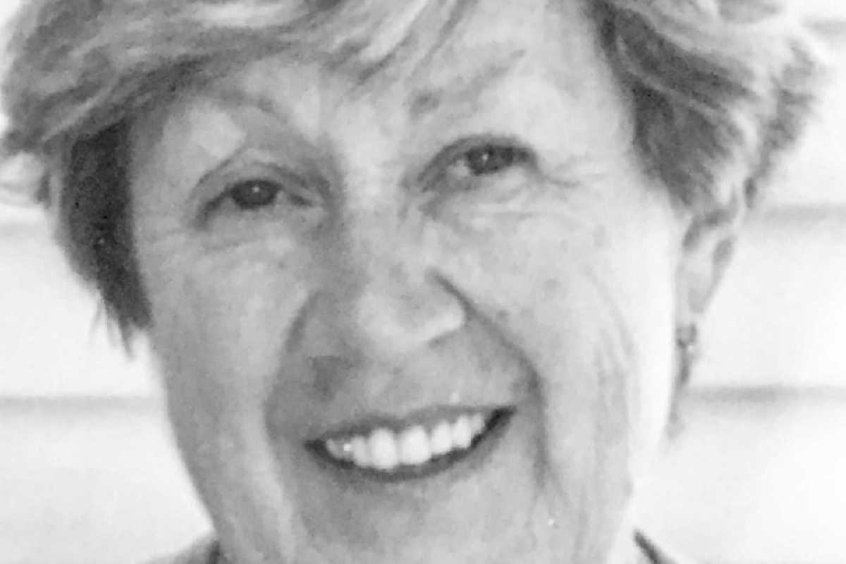
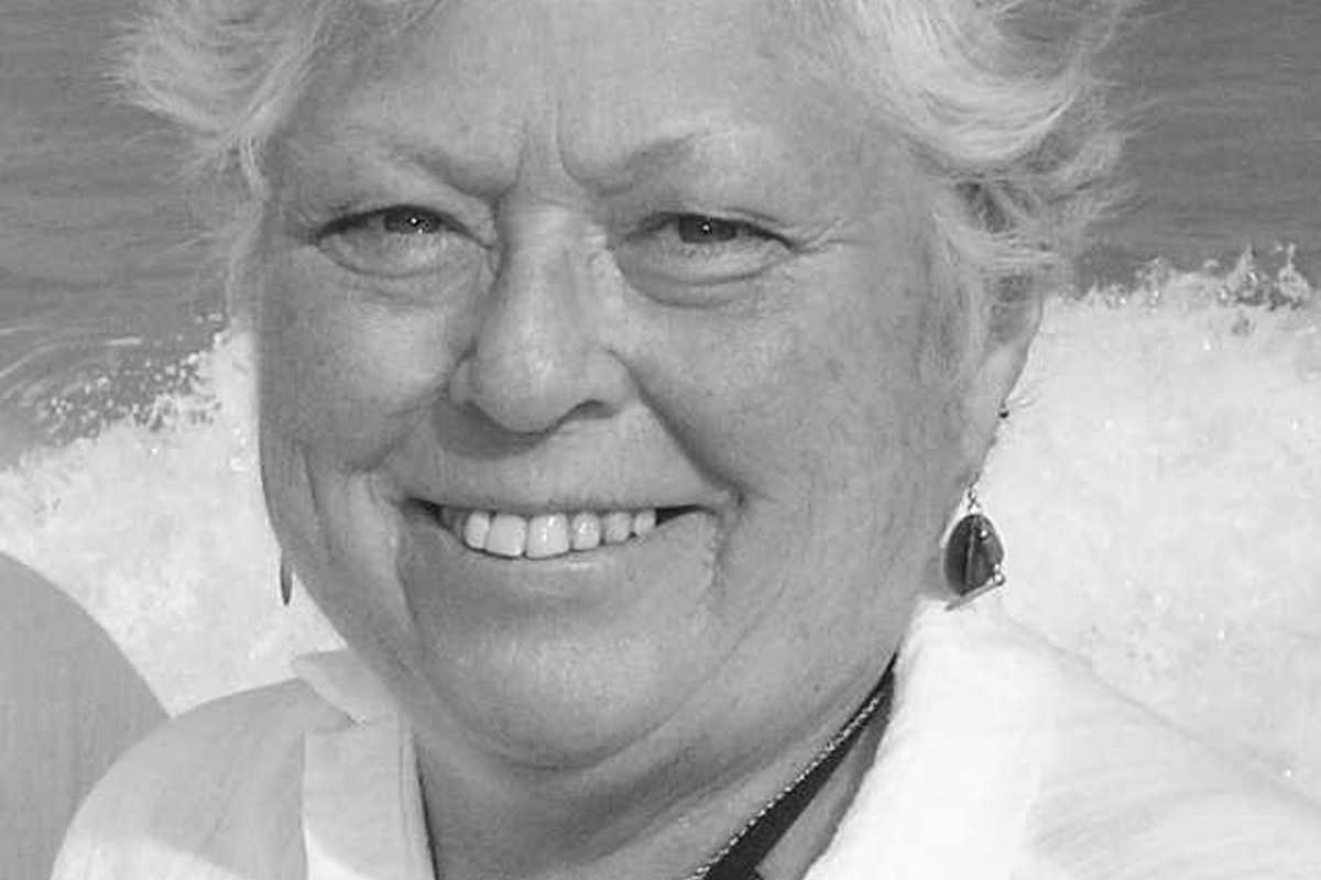
NORFOLK — Sally Sterling Ellis Quale, of Norfolk, Connecticut and St. Petersburg, Florida, formerly of Bronxville, New York, died unexpectedly of heart failure on July 7 at the age of 87.
Sally will be remembered for her deep commitment to her family and communities and for her warmth, kindness, intelligence, creativity …and, of course, for her beautiful smile and deliciously sweet sense of humor. She was a gentle leader, contributing her talents as a teacher, writer, musician, athlete and organizer.
Born in Chestnut Hill, Philadelphia, to Addison Sterling Ellis and Marion Mullison Ellis, Sally was the eldest of three sisters. She graduated from Springside Academy and Smith College, where she was a student leader and an All-American in both lacrosse and field hockey. Devoted to Springside throughout her life, she served on its Board of Trustees and received its Distinguished Service Award for leadership, including establishing an American chestnut arboretum---the restoration of the American chestnut being a lifetime interest of Sally.
Sally began her career as a teacher at The Park School in Brookline, Massachusetts, where she quickly became head of the middle school. Her love of books and writing then led her to New York publishing, where she worked at Random House, Alfred A. Knopf, and Viking Penguin. She continued her active athletic life, playing tennis, co-ed softball and soccer in the publishers’ league in Central Park, and even skiing Tuckerman’s Ravine on Mount Washington.
A gifted pianist, organist and singer, Sally performed with New York’s Blue Hill Troupe, where she met and married the love of her life, Drew Quale. Soon two spirited sons, Andrew III and Addison, arrived and the family moved to Bronxville, New York.
Together they built a life centered on family, community, education, music and sports. She founded the Bronxville Bulletin, became the Bronxville School’s first Public Information Officer, served as Project Director for the publication of the school’s history and produced six Blue Hill Troupe performances to benefit the Bronxville School Foundation, which she and Drew were instrumental in establishing. She directed and accompanied the Bronxville Hilltop band and singers at the Hilltop’s annual Holiday Party. She encouraged many NYC friends to move to Bronxville, who themselves contributed greatly to Bronxville’s educational and musical life.
In 1984, Sally and Drew purchased a 1780 farmhouse in Norfolk, Connecticut as their “casa de campo,” beginning a decades-long love affair with Norfolk, Doolittle Lake and the entire Northwest Corner. In Norfolk, she helped found the town newspaper, Norfolk Now, organized many concerts and cabarets, and produced several Blue Hill Troupe productions for the pre-season opening benefit of the Norfolk Chamber Music Festival. In recent years, Sally and Drew also found a welcoming winter home and deeply caring friends at Westminster Shores in St. Petersburg, Florida.
Sally is survived by her husband, Andrew Christopher Quale Jr.; her sons, Andrew Christopher Quale III and Addison Sterling Ellis Quale; her daughter-in-law, Nágila Pereira Quale; her grandchildren, Strynden Pereira Quale, Amattan Pereira Quale, and Hannah Zeilyn Pereira Quale; her sister, Mimi Garrett; Andrew’s partner, Jessica Euphamie Moore; and many nieces, nephews, extended family members and friends.
Two Memorial Services will be held: Saturday, August 22, 11 AM, at United Church of Christ Congregational, 12 Litchfield Road, Norfolk CT 06058; and Saturday, October 10, 11 AM at Reformed Church of Bronxville, 180 Pondfield Road, Bronxville, NY 10708.

Want more of our stories on Google? Click here to make us a Preferred Source.
Lakeville Journal
KENT — Dorothy McEnroe Casey, 93, a longtime resident of Kent, Connecticut, passed away peacefully on Thursday, July 23, 2026, at New Milford Hospital in New Milford. Born on July 28, 1932 in Sharon, she was the daughter of the late Leo McEnroe, Sr. and Dorothy Belter McEnroe.
Mrs. Casey was a graduate of Amenia High School and a homemaker. On Dec. 1, 1951, at Immaculate Conception Church in Amenia, New York, she married John Finn Casey who died on April 17, 2006.
She was a longtime parishioner of Sacred Heart Church in Kent.
Mrs. Casey is survived by three daughters, Kathleen (Katie) Casey Moore, and her husband, Jonathan, of Kent, Connecticut; Margaret (Meg) McEnroe Casey, of Milwaukee, Wisconsin and Jacqueline (Jackie) Casey McGuinness, and her husband, Michael, of Fairfield, Connecticut and two brothers, Joseph McEnroe of Amenia, New York and James McEnroe of Burlington Flats, New York. She is also survived by six grandchildren, Andrew Casey Moore, and his wife, Kristen; Christopher Sizer Moore; John Finn McFadyen; Margaret Casey McGuinness; Caroline Grace McGuinness and Patrick Edward McGuinness and a great grandson, Aiden Casey Moore.
Besides her parents and husband, she was predeceased by a brother, Leo McEnroe, Jr. and a sister, Margaret Wilcox.
There will be no calling hours. A Mass of Christian Burial will be held at 10 a.m. on Wednesday, Aug. 5, 2026, at St. Kateri Tekakwitha-Sacred Heart Church, 17 Bridge St., Kent, CT. Burial will follow at Sacred Heart Cemetery, Kent, CT. Memorial contributions may be made to the Kent Volunteer Ambulance, 28 Maple St., Kent, CT 06757.
Lakeville Journal
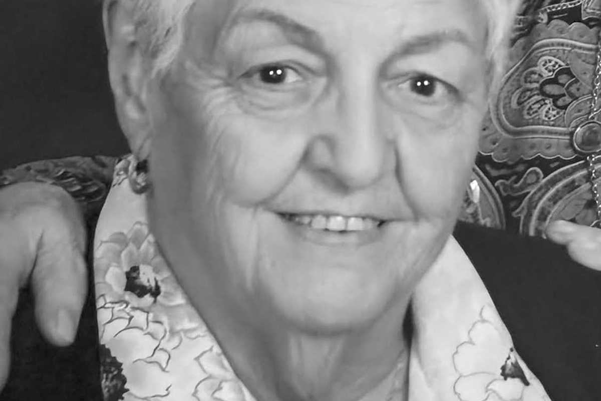
MILLERTON — Louise R. Black, 86, born July 16, 1939, in Queens, New York, died on July 15, 2026, with her partner of 26 years, Mary Howard, by her side. She is also survived by her nephews David Black and Jason Black, and his wife, Kerri; and niece Tiffany Black and her husband, Shlomo Toledano.
After graduating from the University of North Carolina Women’s College and earning two master’s degrees, Louise taught physical education for 35 years at Scarsdale (NY) High School, chairing the department and serving as the first woman Athletic Director. An accomplished fencer, tennis player, and swimmer, Louise’s enduring fondness for sports included a love of the Brooklyn Dodgers, though she never quite recovered from their move to the West Coast.
Louise’s artistic talents came through in her knitting, her painting, and her gardens. A master knitter, for many years she and Mary hosted a weekly knitting group at their home. She was recognized for her Japanese watercolors and landscapes; her passion for flowers was expressed in the abundant roses bordering her property.
An avid traveler, she also found great joy spending summers at her family camp on an island in the Hudson River. Cars and jazz were perennial fascinations, and Doris Day was a favorite.
Louise dedicated much of her life to community service, first as an enthusiastic volunteer at Habitat for Humanity in Westchester County. Following retirement, she moved to Millerton, New York, and was soon immersed in the local library, developing a finders’ guide for the North East Historical Society; and the co-founding of Comida de Vida food pantry at St. Thomas EpiscopalChurch in Amenia, New York.
In lieu of flowers, please consider donating to Food of Life / Comida de Vida Food Pantry St. Thomas Episcopal Church, 40 Leedsville Road, Amenia, NY 12501 (845) 373-9161 www.stthomasamenia.com or Habitat for Humanity: https://www.habitat.org/support
A celebration of Louise’s life will take place on Thursday, July 30, 2026 from 2pm to 4pm at the Scott D. Conklin Funeral Home, 37 Park Avenue, Millerton, NY 12546. To send an online condolence to the family, please visit www.conklinfuneralhome.com
Lakeville Journal
MILLERTON — Mary Simmons, 96, a fifty‑six‑year resident of Millerton, New York, and formerly a lifelong native of College Point, Queens, New York, died peacefully on July 26, 2026, at her daughter’s home in Sharon, Connecticut. Mary devoted her life to her family; to know her was to love her.
Born July 15, 1930, in College Point, Queens, New York, she was the daughter of the late Anthony and Sarah (Longo) Marano. On Oct. 26, 1952, in College Point, New York, she married Ray Daniel Simmons II. Their marriage lasted nearly sixty‑two years; Ray passed away on April 24, 2013. Mary was a longtime parishioner of St. Patrick’s and Immaculate Conception Churches, where she belonged to the Rosary Altar Society. For many years, she enjoyed spending winters in Florida with family and friends. Mary was famous for her Sunday macaroni dinners, which she lovingly prepared for her family and many dear friends throughout the years. All were welcomed, and it was always a packed house. Her greatest joy was spending time with her siblings, children, grandchildren, great‑grandchildren, and her large extended family. She will be deeply missed by all.
Mary is survived by her children; Ray D. Simmons III of Millerton; Maureen Chodan and her husband Jimmy of Florida; Robert A. Simmons and his wife Dara of Amenia Union; Ralph J. Simmons and his husband James Segrue of Spain; Mary Ellen Simmons of Vermont; Roseann Roux and her husband Brian of Sharon, and Louis A. Simmons of Millerton. She is also survived by many grandchildren, great‑grandchildren, and several nieces and nephews. In addition to her parents and husband, she was predeceased by seven siblings and several dear friends and extended family members.
Calling hours will be held on Friday, July 31, 2026, from 1 p.m. to 5 p.m. at the Scott D. Conklin Funeral Home, 37 Park Avenue, Millerton, NY 12546. A Mass of Christian Burial will take place on Saturday, August 1, 2026, at 10 a.m. at St. Kateri Tekakwitha Parish, St. Bernard Church, 52 New Street, Sharon, CT. Rev. Gregory Jaworowski officiating. Interment will follow at St. Patrick’s Church Graveyard at the corner of Barton and Church Streets in Millerton, NY. Memorial contributions may be made to the Millerton Fire Company, P.O. Box 733, Millerton, NY 12546. To send an online condolence to the family, flowers to the service, or to plant a tree in Mary’s honor, please visit www.conklinfuneralhome.com.
Want more of our stories on Google? Click here to make us a Preferred Source.
Want more of our stories on Google? Click here to make us a Preferred Source.