Can you hear me now?
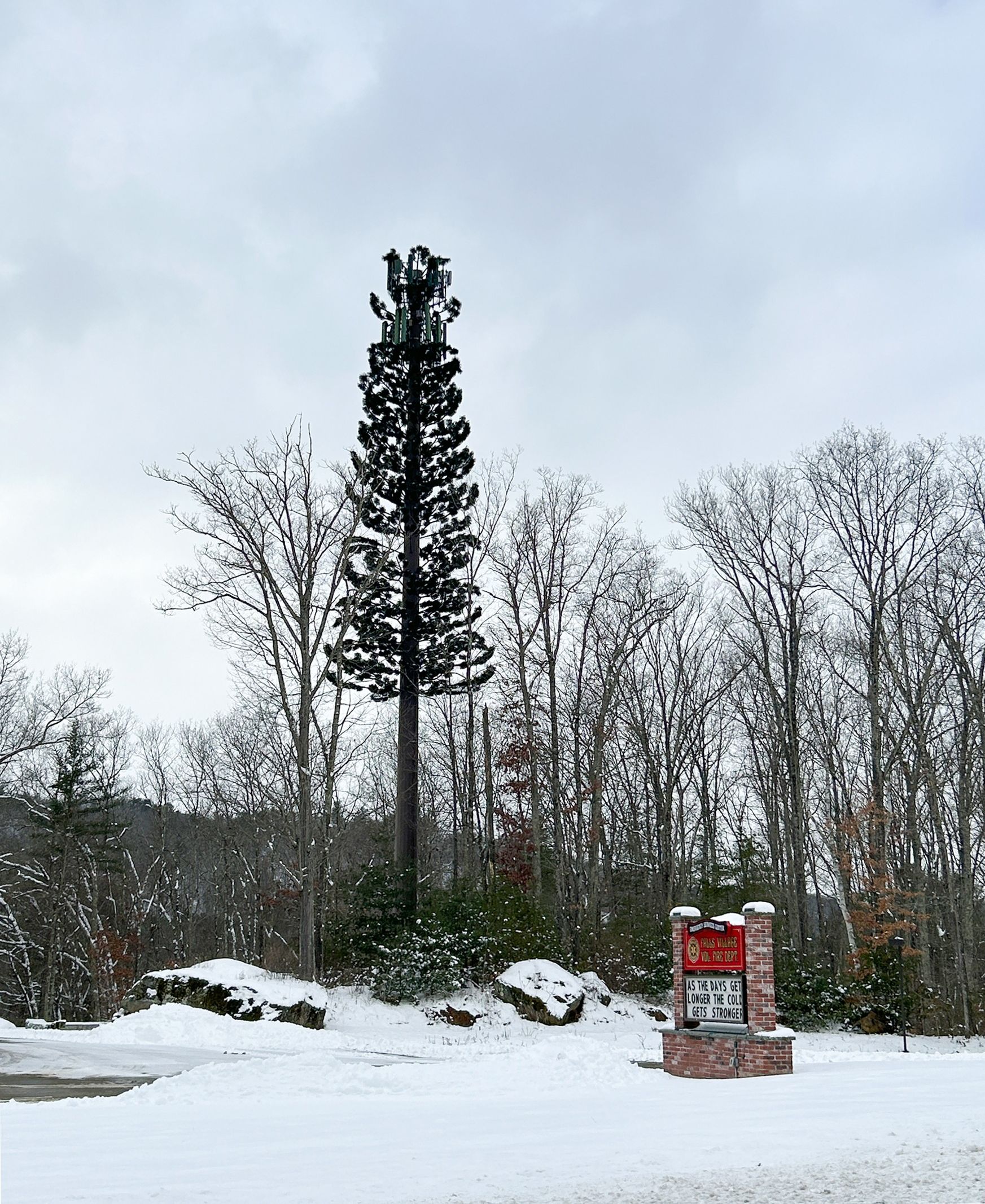
This cell tower by the Falls Village Fire Department on the side of Route 7 is disguised like a tree to better fit in among the rural, forested landscape of the Connecticut's Litchfield hills.
Caitlin Hanlon


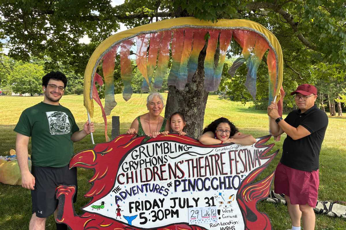
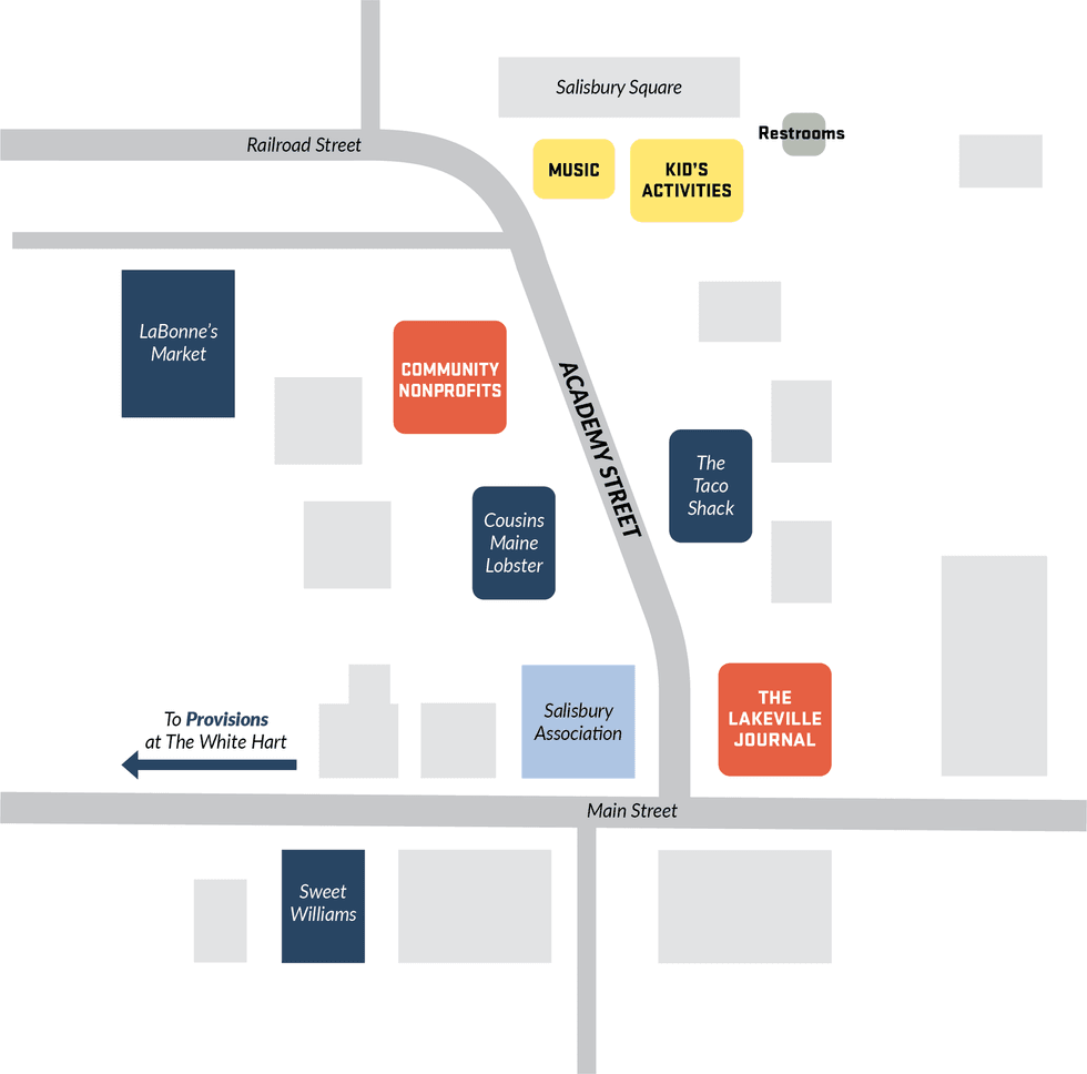
Join The Lakeville Journal for a community celebration, featuring local nonprofits and businesses, festive family fun, great food, and engaging activities.
Danny Tieger | 11am - 12pm
John Keilty/Johnny Rox | 1-3pm
Face Painting
Scavenger Hunt
Balloon Animals
21st Century Fund for HVRHS
Berkshire Taconic Community Foundation
Community Health & Wellness Center
Congregational Church of Salisbury, UCC
The Corner Food Pantry
Crescendo
Housatonic Child Care Center
Noble Horizons
Nuvance Health (Sharon Hospital)
Project SAGE
NW Connecticut Community Foundation (Women & Girls Fund)
Salisbury Association
Salisbury Affordable Housing Commission
Salisbury Housing Committee
Salisbury Housing Trust
The Salisbury Forum
Western Connecticut Area Agency on Aging
Cousins Maine Lobster food truck
The Taco Shack
LaBonnes’ Market
Provisions at The White Hart
Sweet William’s
See you at the Lakeville Journal Street Fair!
If you have any questions, please email streetfair@lakevillejournal.com

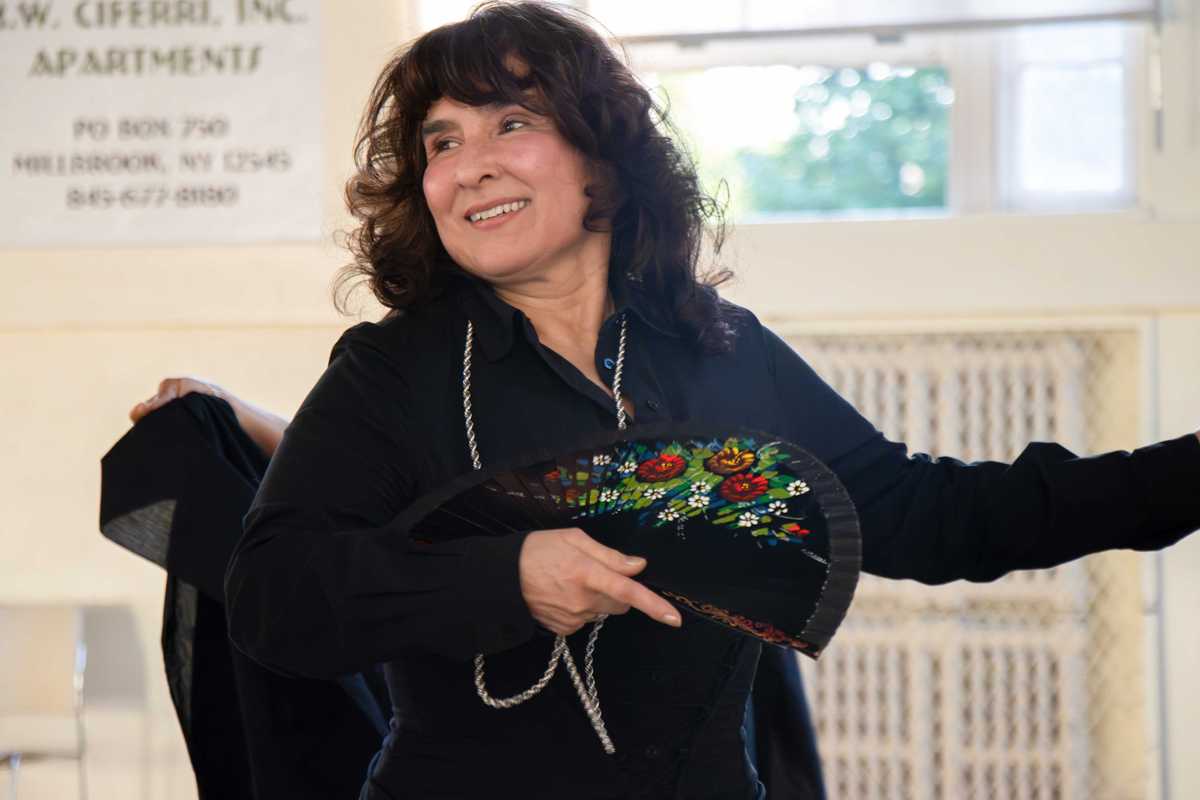
Karina Powers teaches traditional dances from Mexico in Millbrook.
Powers received a master’s degree in Mexican folklore dance from Escuela de la Danza in Baja California, Mexico. Since moving to the United States, she has built a career in performance and teaching. She has not only served as a dance director and performed as a professional vernacular music singer in California, but she has also worked towards her Doctorate, which she will receive in October.
As the founder of her company, Powers works tirelessly to make sure her dancers have everything they need, including costumes, proper flooring, music and a space to practice. Her husband built wooden panels, called tarimas, for students to dance on with their folklórico shoes. Millbrook Mayor Peter F. Doro allows Powers and her group to practice in Millbrook Hall, where she brings the tarimas to every practice along with costumes and proper footwear.
Powers dreams of owning her own studio where she can practice with her group, offer more classes, store costumes and create a space for her dancers to do their hair and makeup before performances. She said she hopes people learn about her classes so her company can grow and she can teach dances from a wider range of Mexican states while having greater access to traditional dress.
As a single mother and professor, Powers’ mother, Carmen Méndez, put her children in dance classes and signed them up for track and field, always keeping them goal- and career-oriented. She helped Powers with her company by creating all of the costumes her dancers wear in their performances. After her mother’s death in 2021, Powers said she has dedicated herself to carrying forward the passion, work ethic and love of dance her mother instilled in her.
“I miss her terribly, and I’m here because of her,” Powers said. “That’s why I want to do this, because of her. She gave me a lot, with the costumes, with her support. I do it for my mom.”
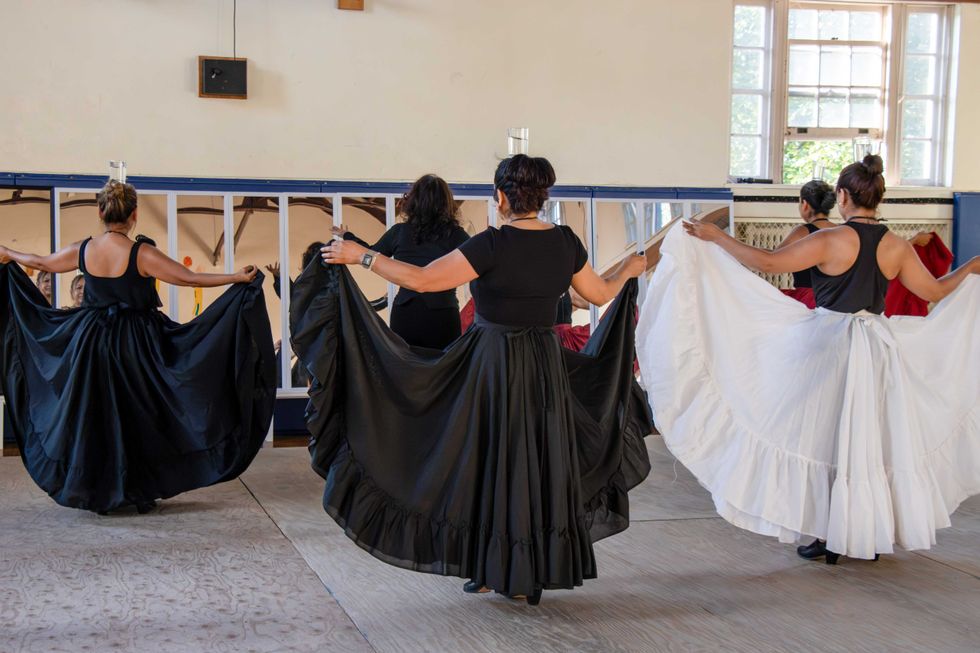 Karina Powers and her students practice in Millbrook Hall.Lucia Iandolo
Dancers in Powers’ group are dedicated to learning the art of dance from different states in Mexico on Tuesday and Friday nights at Millbrook Hall. They travel from many different places in New York to participate, with some dancers traveling more than an hour to make it to rehearsal each week.
“It’s a lot of work, but they learn it. I believe they love it, and it’s a way to come together, to do something good, to do something healthy, and to have people around you who appreciate this kind of art,“ Powers said.
Powers has studied with professor Eloy Jiménez Figueroa since childhood and said his mentorship inspired her to become the teacher she is today. She added that while she may not be the best teacher, she learned from the best.
While living in California, Powers taught elementary, high school and college students, as well as adults. She was recruited to teach traditional Mexican folkloric dance because of the region’s large Mexican community. Today, she encourages people of all backgrounds to explore the rich traditions of Mexican dance.
“This type of dance is not only for people from Mexico,” Powers said. “This is an art and the arts unite nations.”
Powers hopes to continue sharing that art in Millbrook and one day teach in the Millbrook Central School District. Powers and her group will perform at the Millbrook Library on Nov. 21, presenting traditional Mexican dances and inviting audience members to participate.
As a professor, dancer and singer, Powers stays grounded by believing in something greater than herself. She says that praying and putting herself in the hands of God has helped anchor her. She hopes to teach and dance for as long as her body allows.
“My mom, for me, is an angel. I put myself in her hands, and I have faith,” Powers said. “I have faith that God, or something good, is going to be there for the group and for myself.”

Want more of our stories on Google? Click here to make us a Preferred Source.